
A circle trip covering both of these historic trails can make a pleasant casual outing or fill an afternoon with photo opportunities of country scenes. It is a short trip towards town to the intersection of Harding and Patrick Henry Drive. Patrick Henry connects to North Main Street. By traveling north on N. Main you will find Mt. Tabor Road which connects with the Back Road. While it is not clear where one road starts and the other begins , once you navigate the first big curve crossing Mill Creek you know you are on the Back Road.
A short circle can be selected by turning down Dry Run. But continuing down the road increases the photo opportunities.

Even the rare straight stretches can fill your lenses with colorful contrast...

... a brown bromsedge covered hill contrasts with the green
meadow...

... or if horses or homes attract your fancy, there will be something to add to your photographic album.

We started our circle back by turning down Gallion Ridge. A surprise awaits on Gallion Ridge; a French B&B.
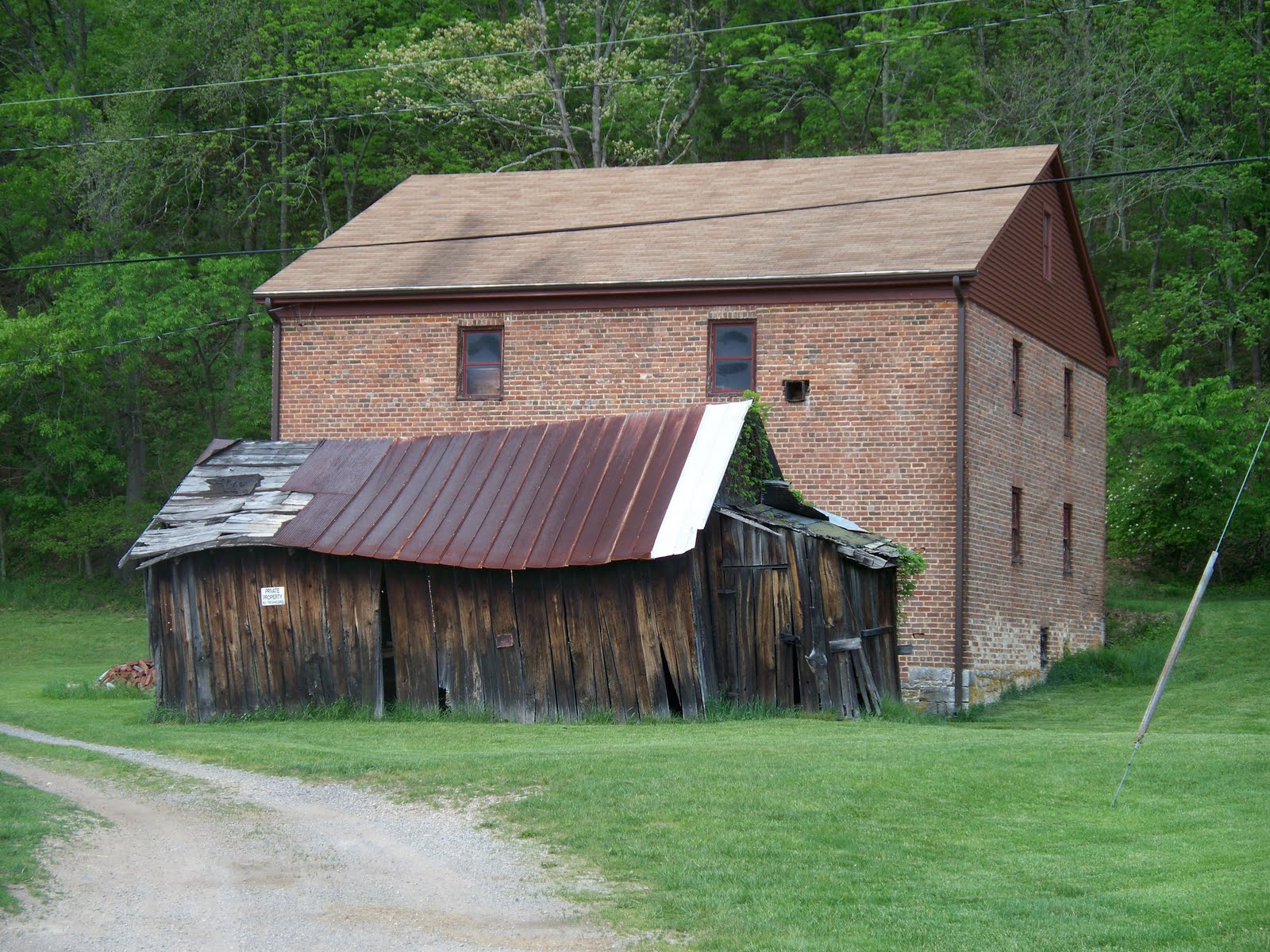
This gravel connector leads you to a panoramic view of the upper Roanoke Valley and directs you onto 785 at a point to get a good view of the Yost's log house and McDonald's Mill.


The road passes many marked and unmarked
historic landmarks as it meanders towards
Luster's Gate. The old Grubb's House must have a
lot of stories. It appears old enough to have
been there when the road was the Indian Road.

The log store was operated by Walter Bennet and Bax Johnson was often there according to my dad. This was a place to buy supplies or visit with Bax. You get the impression farmers didn't need many supplies!
You know you are making a circle when you see another non functioning mill that was fed by Mill Creek, the same one crossed near the start of the Back Road. The old map identifies it as Bennet's Mill.

This attractive home was formerly a school until consolidation. You can see it was well built as you observe the straight lines of the old school.
You can complete the circle by continuing on by the old cheese plant, up the mountain, around Ryan's Curve( or Craig's Bend) , passing the Bug Shop to Wrights Way and the Cozy Cottage.
There are many places of interest neither photographed nor described in this blog. That means we will just have to make the loop again!
There are many places of interest neither photographed nor described in this blog. That means we will just have to make the loop again!
My cousins that grew up within view of the mill have added insight to this blog. Carl said Uncle Creed told him the names of people that settled near the streams that came from each holler-not hollow. Carl mentioned how well balanced all the wheels and gears were in the old mill. Hope played in the mill and rode the grinding stones like a playground whirly -gig or merry-go-round.
ReplyDelete